 Cart(
Cart(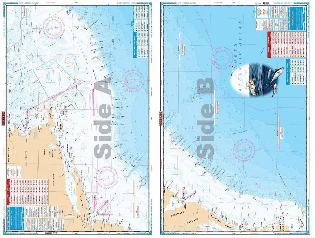


Waterproof Charts IC Inshore and Offshore Nautical Charts
The producers of the Original Waterproof charts. Waterproof Charts, Inc. was started in 1984, and was the 1st company to successfully re-compile NOAA information and print it on a waterproof, tear resistant paper. With so many years of experience, you can be assured that you are dealing with a knowledgeable charts maker. Waterproof Charts was awarded US Patent # 4,687,230 for its first and one of a kind product. All charts are protected under US Copyright laws.
Waterproof Charts strive to keep the Original Waterproof Charts up to date, and will often include additional valuable features in their charts, such as pre-plotted GPS coordinates and waterfront dining and fueling locations. Waterproof Charts offers a complete line up of charts for many regions of the United States which includes both Offshore and Inshore versions.
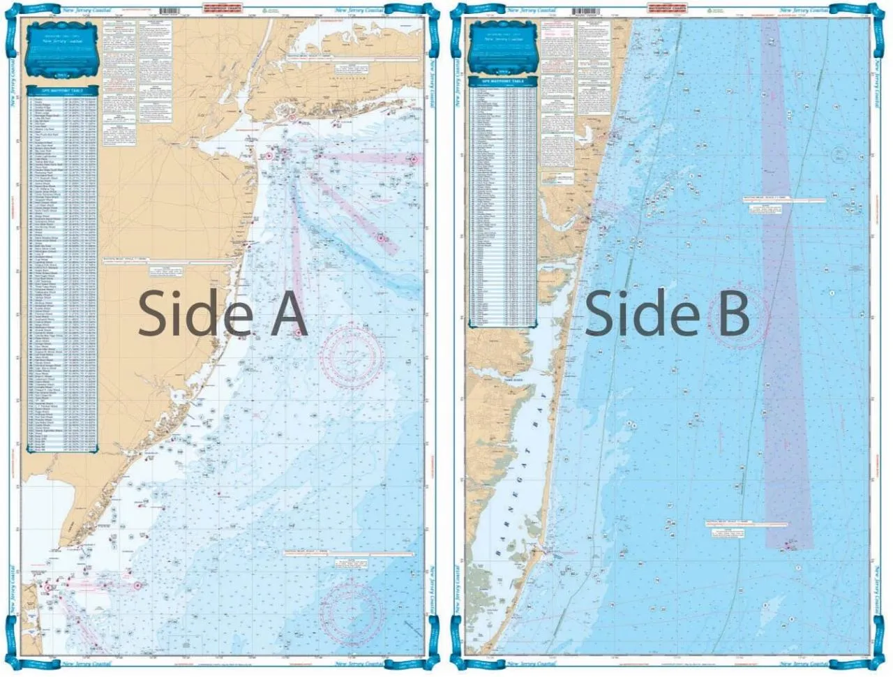
55F - New Jersey Coastal Fishing Chart
The best chart for fishing or diving off of New Jersey. Side A covers all of Coastal New Jersey from Long Island south to 20 miles south of Cape May. 4 different colors are used to describe water depths. Coverage is offshore to 73 degrees 10 Minutes West Longitude. Side B covers the area from Long Branch south to Barnegat Inlet in better detail (does not cover Barnegat Bay or other insidewaters - for detail inside see chart #56). A total of 244 PLOTTED GPS POSITIONS are given for reefs and wrecks, fish havens, rocks, lights, and buoys. Each waypoint is individually plotted so you can see its position relative to other sites, and inlets.
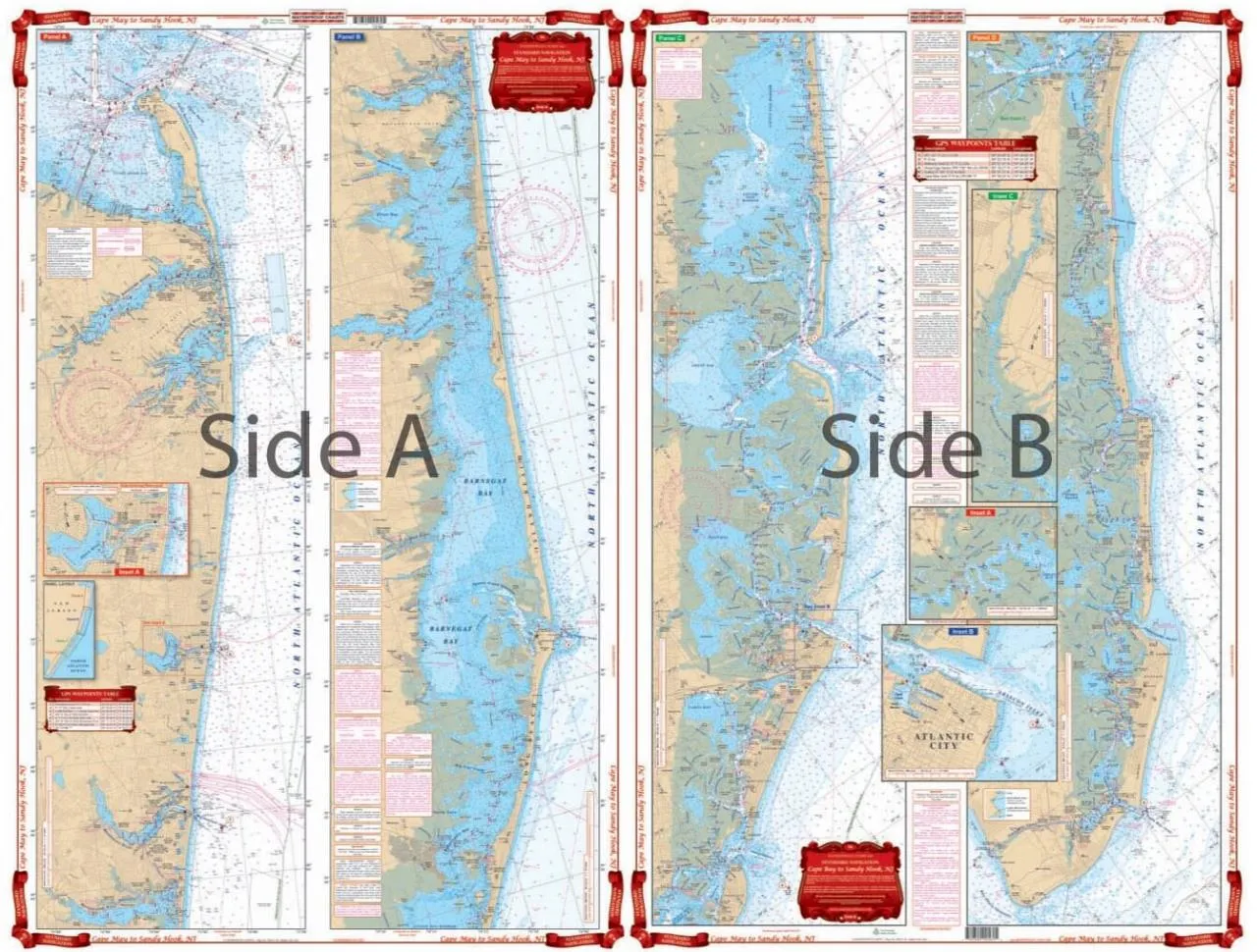
56 - Cape May to Sandy Hook NJ Navigation Chart (Intercoastal Waterway)
Complete inside coverage for the New Jersey Shore from Cape May and the Cape May Canal north through Avalon and Ocean City, including Atlantic City, through Great Bay and Little Egg Harbor on the south side. The north panel covers all of Barnegat Bay and Toms River, through the Point Pleasant canal and the Manasquan River. Also covers the Shark River, the Shrewsbury River, the Navesink River and Red Bank and Sandy Hook Bay and Atlantic Highlands. Details are provided for the Shark River, Manasquan Inlet, and Atlantic City. A colored key on each side and large print place names make areas very easy to find.
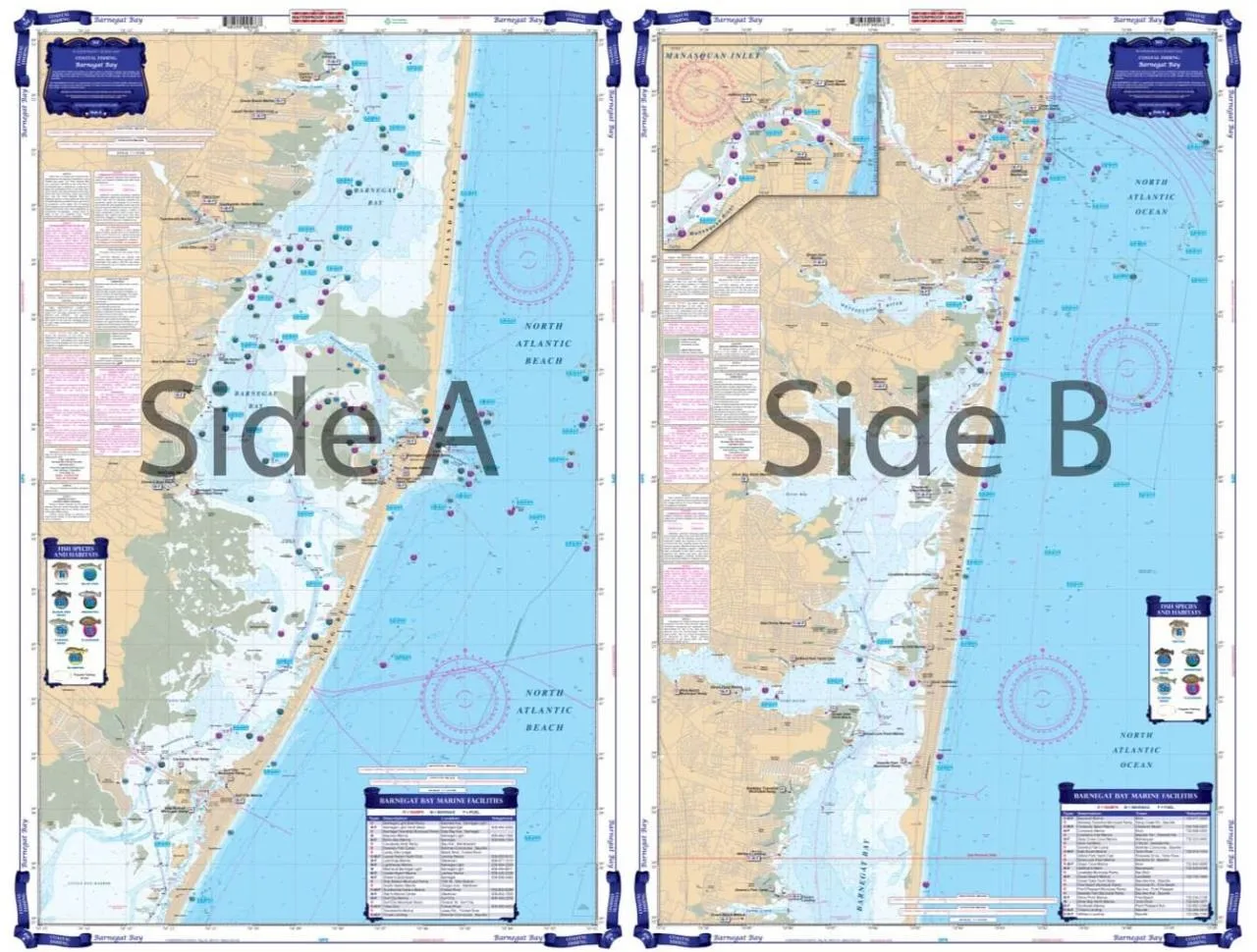
56E - Barnegat Bay Large Print Navigation Chart
This large print chart covers the Manasquan Inlet Bay Head, the Metedconk River, and the Toms River areas. Provides coastal coverage up to 4 miles offshore. This chart includes 31 sets of plotted GPS coordinates on the chart. Don't leave the dock without this Barnegat Bay nautical map. This large print navigation chart covers the Manasquan Inlet Bay Head, the Metedeconk River, and the Toms River areas.
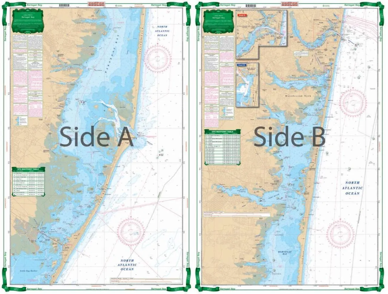
56F - Barnegat Bay Coastal Fishing Chart
This is the newest addition to our Coastal Fishing Charts. Side A of this chart includes coverage from Manasquan Inlet to the Southwest 15 miles based upon information from NOAA Chart #12324. It has excellent coverage of Metedeconk River, Toms River and the Northeastern end of Barnegat Bay. Side B contains information from NOAA Charts #12323 and #12324. Coverage begins with Cedar Creek down to Barnegat Inlet 9 miles to the Southwest, with great detail of the inlet and Barnegat Bay.
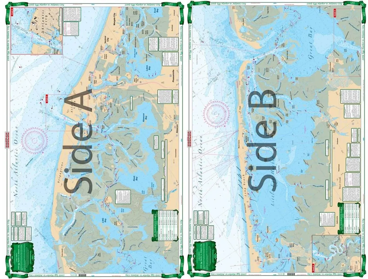
156E - Little Egg Harbor To Atlantic City Large Print Navigation Chart
This chart also covers Lakes Bay, Absecon Bay and Reed Bay as well as detail of Atlantic City and Absecon Inlet. GPS Coordinates. Don't leave the dock without this nautical map covering the area between Little Egg Harbor to Atlantic City. Wouldn't you rather hit the waters, than hit up the casinos anyways?
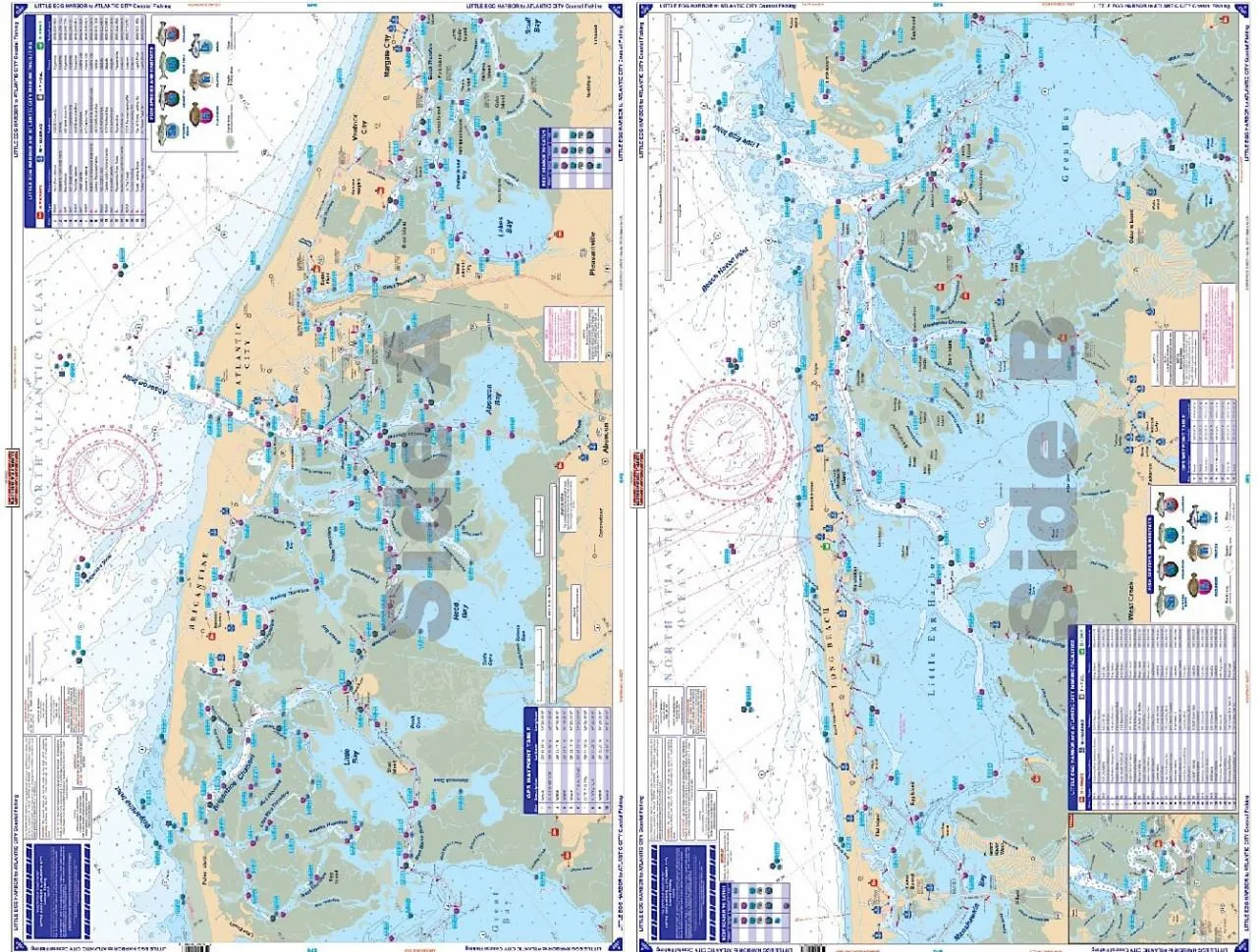
156F - Little Egg Harbor To Atlantic City Coastal Fishing Chart
Extremely detailed coverage including the complex inside waterways and rivers from Route 72 bridge southwest to Little Egg Inlet and up the Mullica River. The reverse side continues from Great Bay and Brigantine Inlet to Atlantic City, Ventnor, and Margate City.
164F - Bluefin, Georges, Canyons Maxi Offshore Fishing Chart
This new chart is for the Offshore Fisherman that targets the Canyons from MA to NC. Side A lists 24 Canyons starting with Georges Canyon to Toms Canyon. Canyons are listed by name with Latitude & Longitude Coordinates. Also included are known fishing areas such as Rodgers Basin, Franklin Basin, Mayo Swell, Cultivator Shoal and many others.


